The Alpe Adria cycle route (in German Alpe Adria Radweg; classified in Italy as FVG 1 and in Austria as R3) is a cycle route from Salzburg, Austria, to Grado, Italy. Eight stages connect the city of Mozart with the Adriatic Sea via the Alps. The Alpe Adria Cycle Route crosses the Alps partly along old railway tracks and through several tunnels. A pleasant itinerary on two wheels that is highly satisfying in many respects: culture, sport, gastronomy!
Story
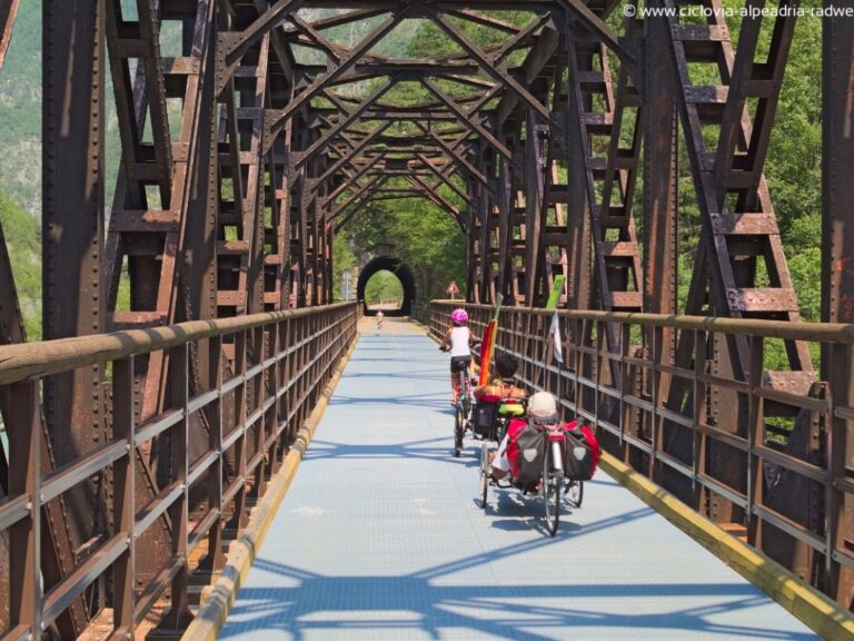
In the province of Udine, between Resiutta and Tarvisio (disused Tarvisio Centrale station), the cycle path was built by upgrading the old single-track route of the Pontebbana railway, which was disused from 1985 to 2000, moving the new route mostly through tunnels, in the section between Tarvisio and Moggio Udinese.
The first project of the cycle track was sketched out by the Province of Udine itself in 1994. This, however, seemed to encounter some difficulties in abandoning the first ideational and study phase to move on to the design phase.
The inauguration of the Italian section took place in sections from 2005 to 2009. On 31 August 2011, the works reached Chiusaforte and the old station was temporarily closed. In March 2014, once the works were finished, it was reopened.
Route
The route is covered in its entirety in 8 days from Salzburg to Grado, covering 415 km of which approximately 232 km on Austrian territory and 183 km on Italian territory, crossing the valleys of the Salzburg Alps and the Alps of Carinthia and Slovenia on Austrian territory, the Italian Julian Alps (Val Canale), the Canal del Ferro and the entire eastern Friulian Plain as far as the Upper Adriatic on the Italian side.
From Salzburg (425 m), the city of Mozart located on the banks of the Salzach River on the northern border of the Alps and Austria, the route runs through the Salzach Valley and the Gastein Valley to Böckstein. From here, the shuttle train takes 11 minutes to Mallnitz (1,191 m), and then again by bike through Carinthia to Spittal an der Drau, Villach and Arnoldstein on the Austrian-Italian border. On Italian territory, the route runs partly along the route of the old, disused railway line, and from Tarvisio touches Gemona, Udine, Aquileia and finally Grado on the Adriatic Sea.
Stages
1ª stage: Salisburgo- Bischofshofen 54,00 km;
2ª stage: Bischofshofen-Bad Gastein 51,86 km;
3ª stage: Bad Gastein/Mallnitz-Spittal an der Drau 58,85 km;
4ª stage: Spittal an d. Drau-Villaco 39,07 km;
5ª stage: Villaco-Tarvisio 36,89 km;
6ª stage: Tarvisio-Venzone 60,43 km;
7ª stage: Venzone-Udine 55,44 km;
8ª stage: Udine-Grado 59,07 km;
Altitude difference
Salisburgo-Grado: ascent 2417 m / descent 2842 m
Grado-Salisburgo: ascent 2842 m / descent 2417 m